


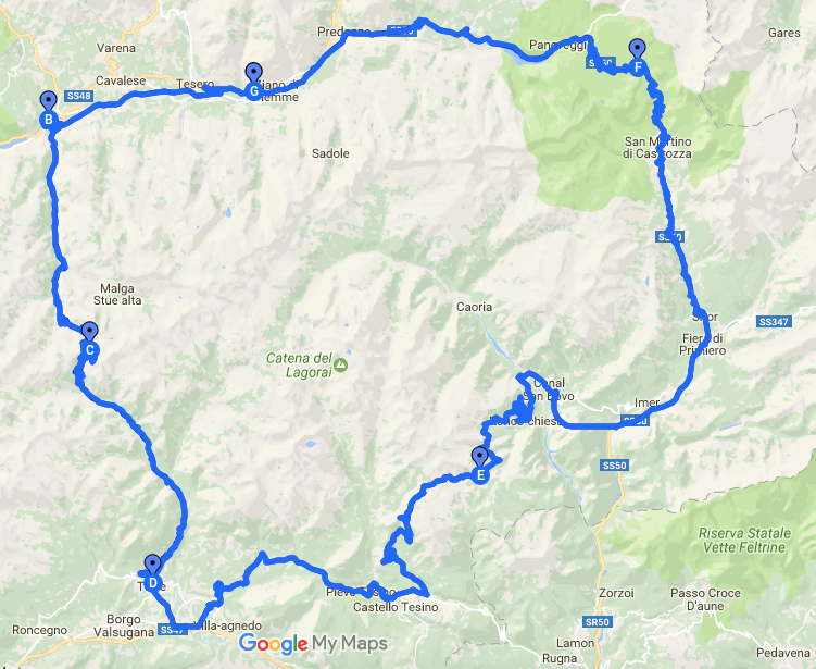
Panchià-Passo Manghen-Telve -Strigno-passo Broccon- Passo Rolle-Panchià

Panchià-Passo Manghen-Telve -Strigno-passo Broccon- Passo Rolle-Panchià
![]()

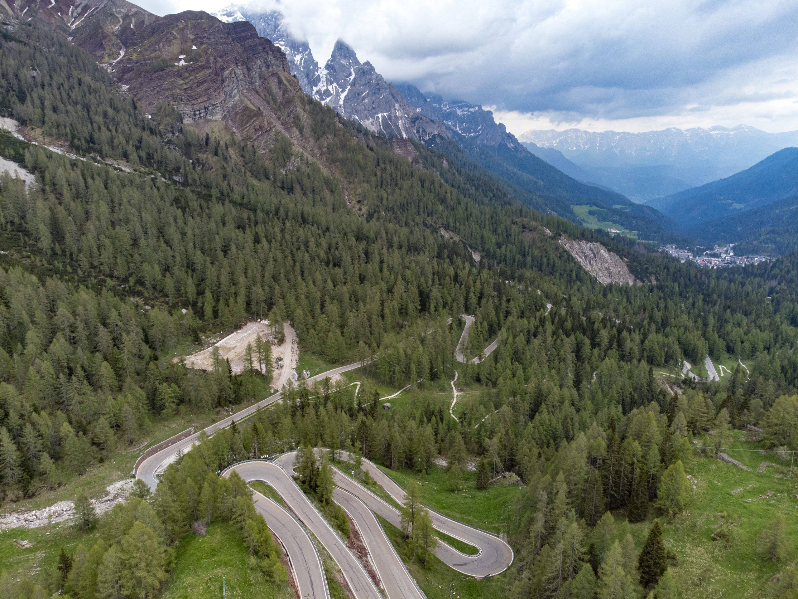
![]() Our tour starts in front of the hotel Panorama, from where we turn downhill to the right and get to the state road of the Dolomites (SS 48). On this road we drive for about 250 meters to a traffic light not far from the church of Panchià. At the traffic light, we turn left onto a steep gravel road, cross the river Avisio on a roofed wooden bridge and then turn left. After about 300 meters, we continue to the left and drive along the valley road to Tesero, Cavalese and the ski lifts of the Alpe Cermis. After about seven kilometers we come across a roundabout, which we leave at the second exit in the direction of Molina di Fiemme. At the next roundabout, we take the third exit. It leads us to the Passo Manghen road, which starts after the bridge over the Avisio. The pass road is 16.4 kilometers long. After a first steep section the road is almost flat for a long time, while the last part winds up steeply uphill again – fortunately with some hairpin bends.
Our tour starts in front of the hotel Panorama, from where we turn downhill to the right and get to the state road of the Dolomites (SS 48). On this road we drive for about 250 meters to a traffic light not far from the church of Panchià. At the traffic light, we turn left onto a steep gravel road, cross the river Avisio on a roofed wooden bridge and then turn left. After about 300 meters, we continue to the left and drive along the valley road to Tesero, Cavalese and the ski lifts of the Alpe Cermis. After about seven kilometers we come across a roundabout, which we leave at the second exit in the direction of Molina di Fiemme. At the next roundabout, we take the third exit. It leads us to the Passo Manghen road, which starts after the bridge over the Avisio. The pass road is 16.4 kilometers long. After a first steep section the road is almost flat for a long time, while the last part winds up steeply uphill again – fortunately with some hairpin bends.
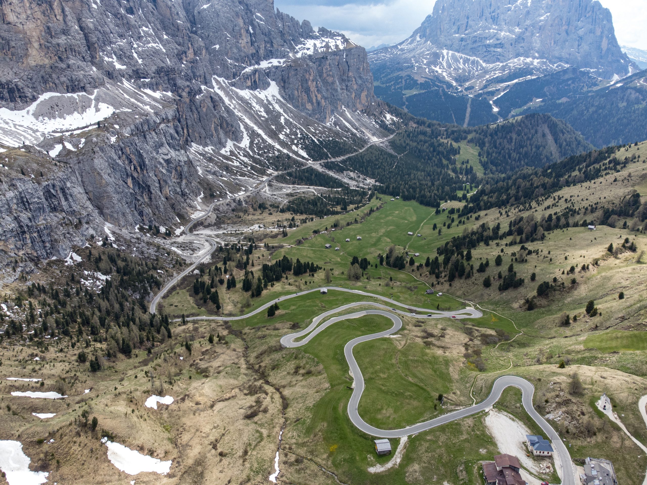
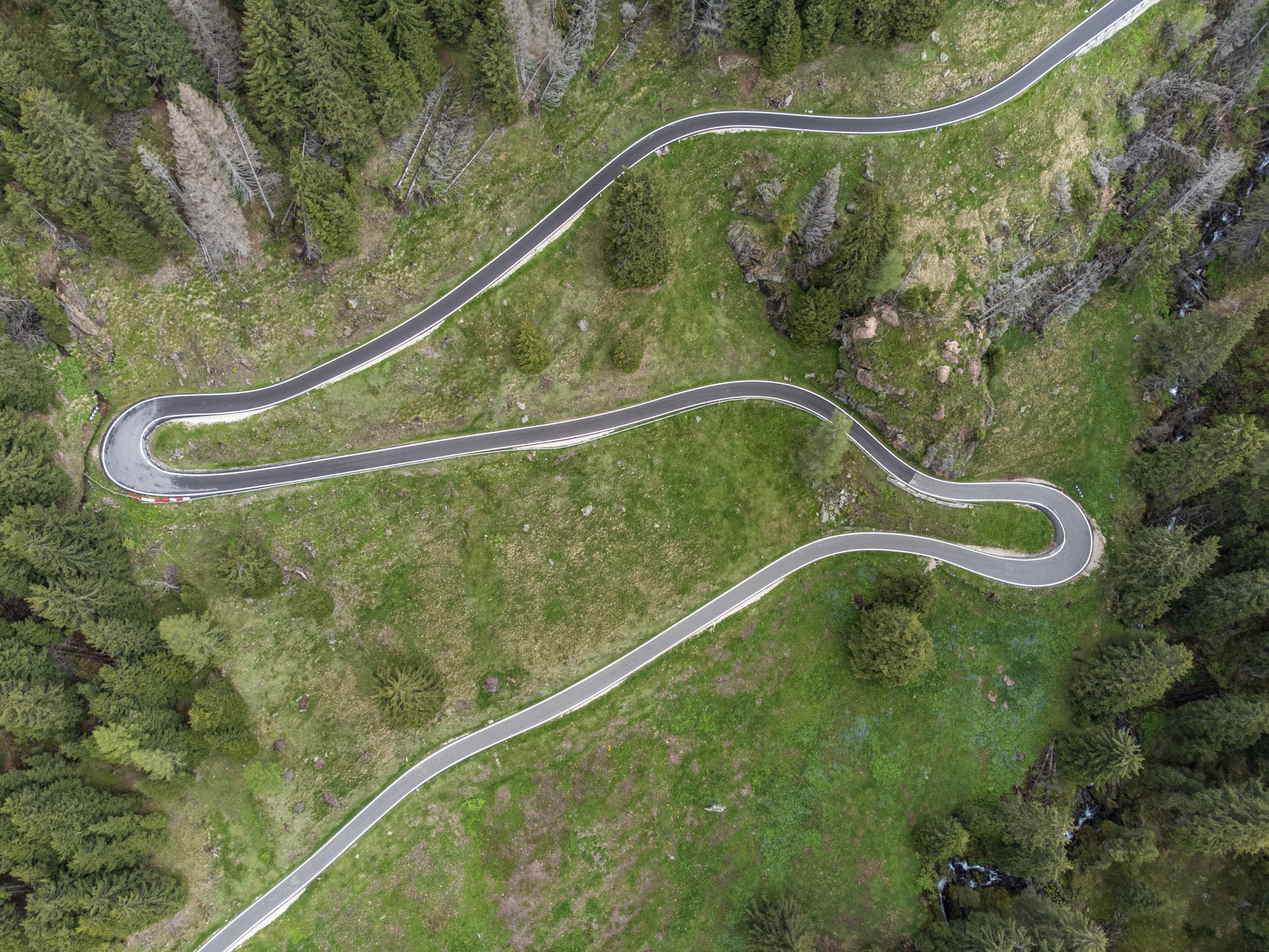
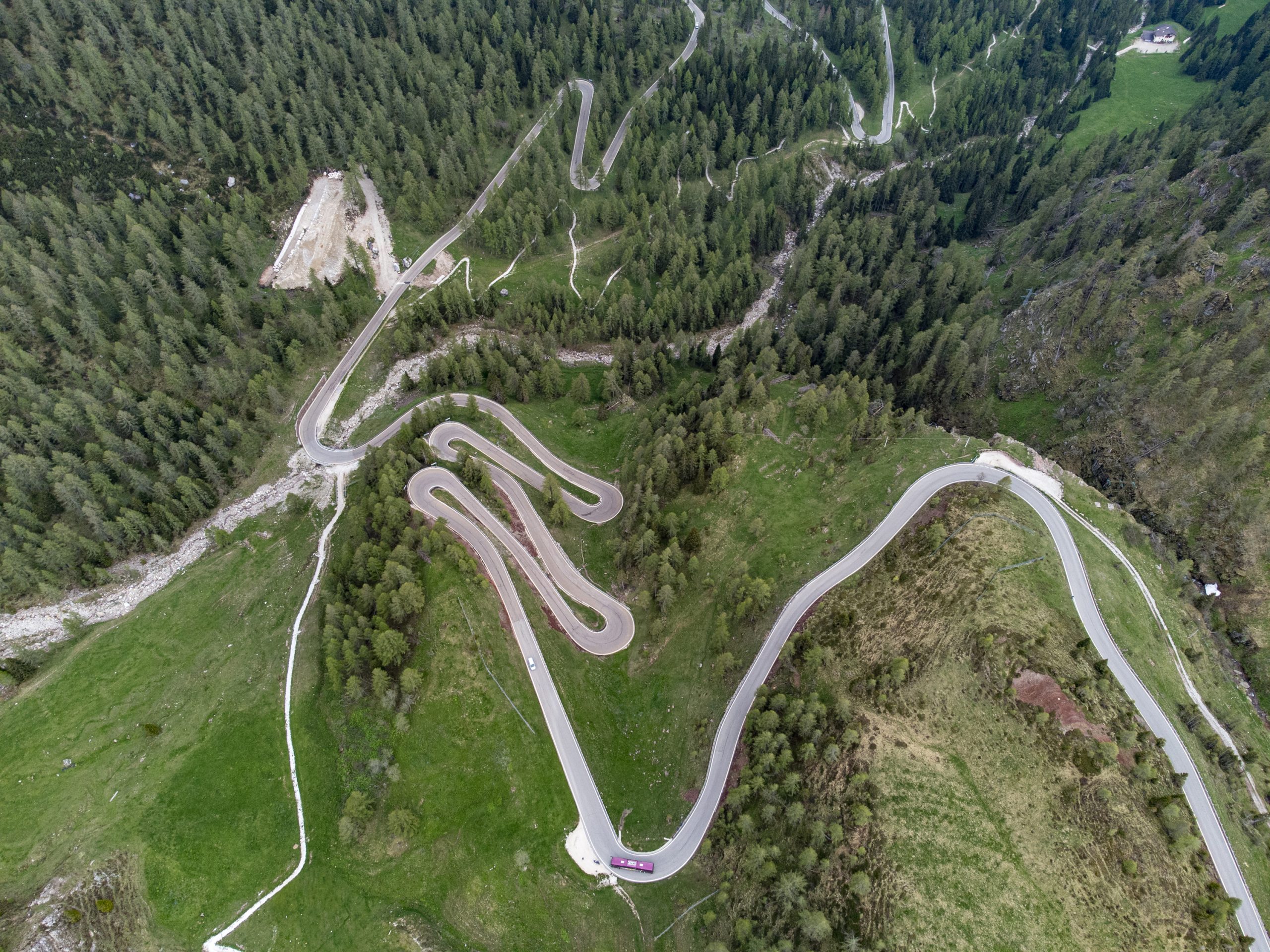
At 2047 meters above sea level, we reach Passo Manghen and enjoy a wonderful view of the small mountain lake and the Lagorai mountain range. Leaving the pass behind us, the route descends quickly and for a long time: about 20 kilometers down the slope, we pass by Telve and Castelnuovo and turn left onto the Valsugana road (SS 47). We follow the road to Strigno. Continue on the state road (SP 78) via Bieno and Castel Tesino, through forests, meadows and pastures, past the Lagorai ski resort up to Passo Broccon at 1616 meters above sea level.
The pass connects the high plateau of Tesino with Valle del Vanoi flanked by the Lagorai mountain range. We drive down from the pass to Canal San Bovo on endless curves and hairpin bends. Here we have two options. We can turn left towards Passo Gobbera or continue straight through the tunnel. If we decide for Passo Gobbera, the road climbs again and then leads downhill to Imer. From there we continue to Mezzano and follow the signs “Passo Rolle”. If we decide for the tunnel, we come to a roundabout and leave this in the direction of Passo Rolle. Through the Valle del Primiero and the villages of Transacqua, Fiera di Primiero and Siror, we reach San Martino di Castrozza, known as the place that lies at the foot of the impressive Pale di San Martino. This place is an Eldorado for skiers and mountaineers.
Leaving San Martino behind us, we reach Passo Rolle at 1984 meters above sea level and directly beneath the Pale di San Martino. Those who have enough time should plan a trip into nature here, for example, a hike to the Segantini hut, a unique and stunning location.
From Passo Rolle, we ride comfortably downhill on the edge of the Paneveggio nature park towards Val di Fiemme. Attention: It might happen that you meet deer or roe deer on the road. The Paneveggio nature park is protected since 1967 and covers almost 20,000 hectares. We follow the signs “Predazzo”, drive along the Forte Buso lake and arrive to Bellamonte. About3 km further we enter the village Predazzo. Here we suggest you to keep left until you come to a roundabout and take the third exit here. We pass a few petrol stations, reach a small bridge in the artisan zone and continue towards another roundabout that we leave in the direction of Cavalese/Ziano.On the roundabout number three, we take the second exit, leave the tunnel on the right side and continue towards Ziano. In Ziano, just one kilometer away from Panchià, we turn right at the first set of traffic lights and go back uphill to Hotel Panorama.
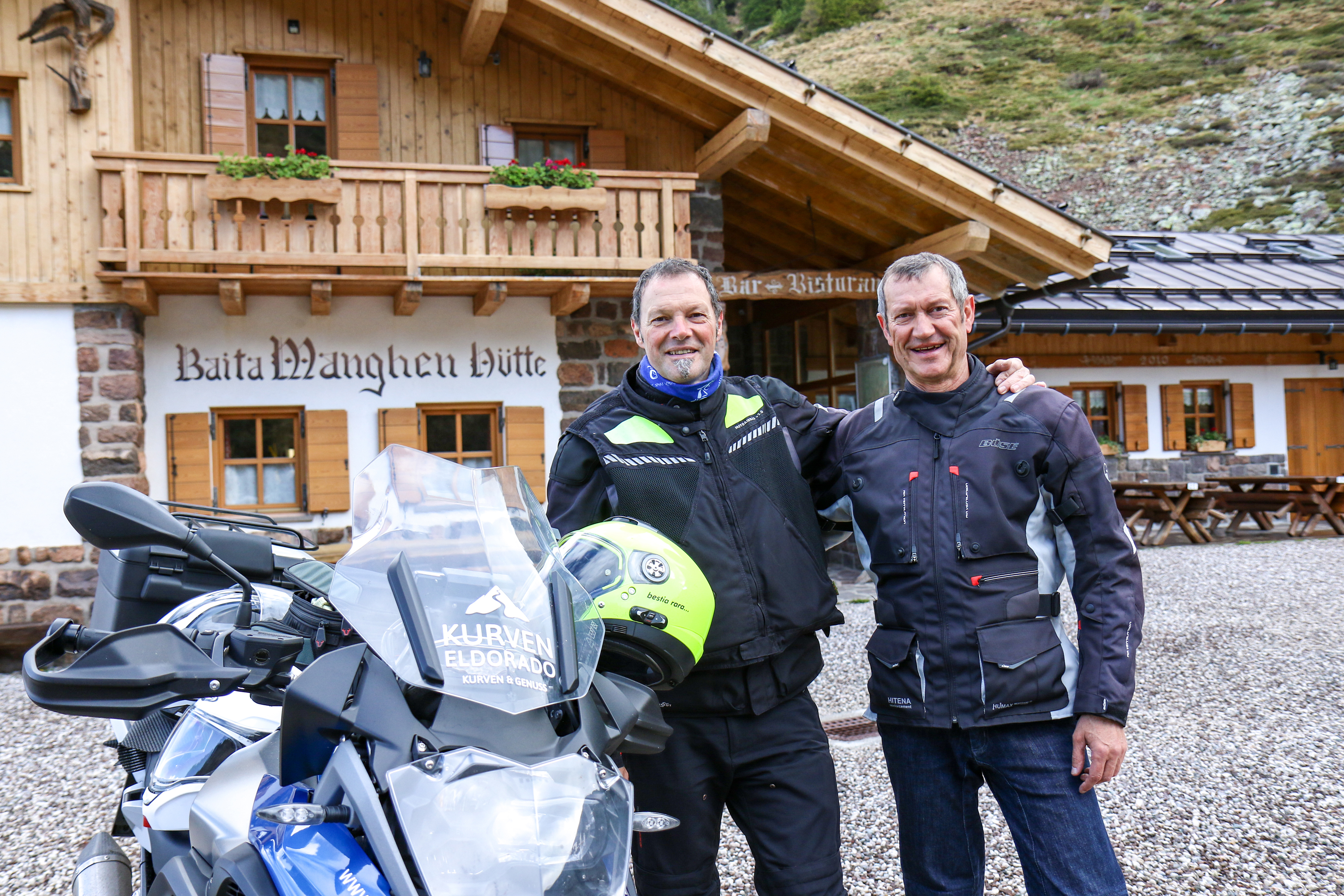
Tour in Moto
| Distance | 162 km |
| Difficolty | Medium |
| Travel time | 4.00h |
Albergo Panorama ***
Via Templari, 51 - I-38030 Panchia' (TN) Val di Fiemme info@albergopanorama.it T. +39 0462 813137 F. +39 0462 810136 M. +39 335 74 29 377 GPS N 46.286335 E 11.548111 Vat number 01096690225